Naviate for Cloud release news
Naviate Outdoor Area February release news 2024
Release news for Naviate Outdoor Area. Highlights includes the features Achieved Outdoor Area, Sunlit Analyze, Road Noise Analyze and Terrain Steepness Analyze.
-
Feature
-
Feature
-
Feature
-
Feature
Note. Regulations differ from municipalities and countries, this first version of the software is created with Norwegian regulations in mind, but can be used by everyone with similar requirement standards.
Prerequisites and limitations for first test version:
- Maximum Available Outdoor Area is always based on the Site with footprint of Buildings subtracted.
- Achieved Outdoor Area is calculated based on the given percentage of any selected Building Area in Forma.
You can also subtract:
- Parts of the Site with terrain steepness above given value
- Parts of the Site with Road Noise above given value
- Sunlit analyze do not subtract the shaded area from Achieved Outdoor Area
- Sunlit Area is analyzed and reported as percentage and area of complete Site without reduction of areas from Terrain Steepness and Road Noise analyzes.
- It is only possible to see the results of each analyze graphically (as red/green area), not as combined result.
- The look of the User Interface is not following Forma UI Guidelines
We are working on improvements and will update this unpublished beta version when we have solutions to the limitations mentioned above.
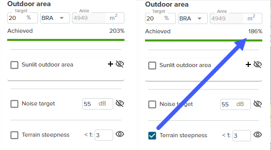
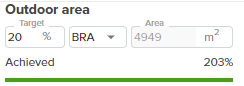
Achieved Outdoor Area
The defined building site with the building footprint removed is recognized as the maximum available outdoor area.
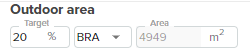
Specify the targeted outdoor area with a percentage of any of the available building are types in the project.
The achieved outdoor area is calculated from the maximum available outdoor area and shown in the achieved bar.
The result is not considering terrain steepness, road noise or sunlit areas at this step. When you perform any of these additional analuzes, the achieved outdoor area bar result will be updated.
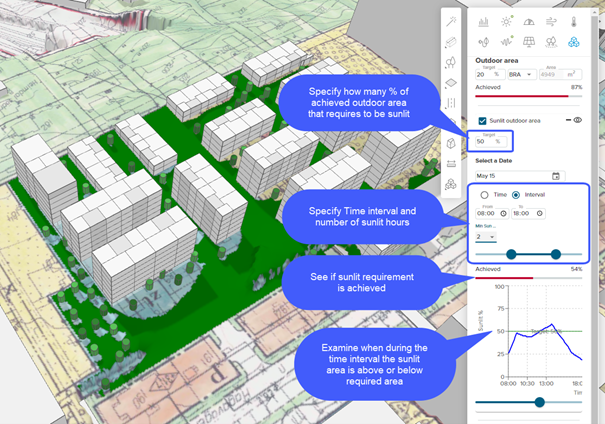
Sunlit analyze
Visualize sunlit areas for specific dates and times, number of hours during a set period or percentage of sunlit area.
The analyzed results use Forma Sun Hours calculation; if there is no valid sun hours calculation performed for the day you specified, a "run analyze" button is displayed.
Specify a date and time for the sunlit analyze, and visualize what part of the Achieved Outdoor Area that is sunlit by clicking on the "eye-toggle".
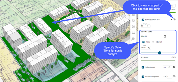
Or specify a date interval and number of hours that should be sunlit and on how large the Achieved Outdoor Area that needs to be sunlit to examine if the building site is below or above the target.
Road Noise analyze
Adresses the noise levels on the building site to remove areas that are above specified noise levels.
The analyzed results use Forma Road Noise calculation; if there is no valid road noise calculation for the active proposal, you are asked to run the analyze.
Note. You must add roads and enter traffic information in Forma to do the Road Noise Analyze.
Enter the maximum allowed noise level in decibel (dB), and the area of the building site will be analyzed. Use the "toggle-eye" to visualize what part of the site is below and above the entered noice level.
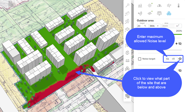
In the image above, all parts of the building site marked with red color is defined as higher or equal to 55dB. The green parts define the areas below 55dB, and hence accepted as outdoor area.
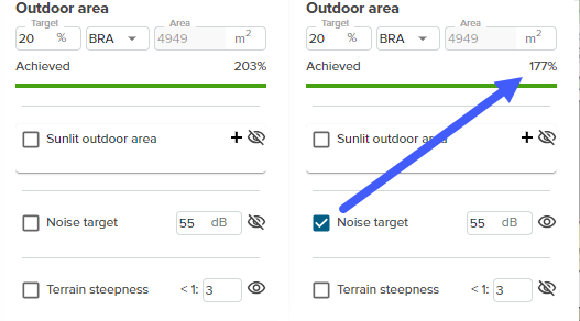
When you enable the noise target toggle button, you include the Road Noise Analyze in the Achieved Outdoor Area Analyxe, and the achieve bar in the top of the dialog is updated; only the defined green areas of the building site is included.
Terrain Steepness analyze
Find the steepness of the terrain with a terrain ratio; all parts of the building site with steepness above entered ratio are removed from the available outdoor area.
Use the "toggle-eye" to visualize what part of the building site that is within the target values.
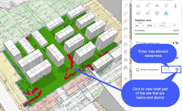
In the image above, all parts of the building site defined with red color have steepness higher or equal to 1:3. The green areas are below 1:3.
When you enable the Terrain Steepness toggle-button, you include the terrain Steepness analyze in the Achieved Outdoor Area analyze, and the bar in the dialog is updated; only the defined green areas is included.